TAIPEI (TVBS News) — The former head of the weather administration attributed Taiwan's lingering high temperatures after the Mid-Autumn Festival to the jet stream on Thursday (Sept. 19).
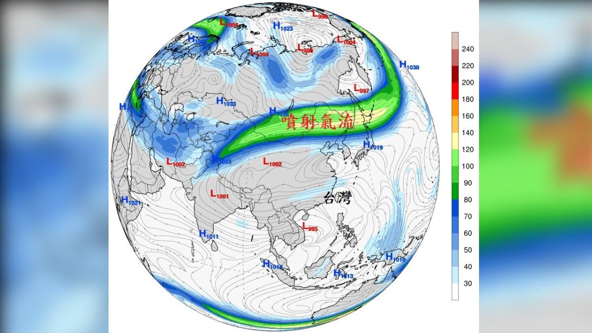
Cheng Ming-dean (鄭明典) explained the weather patterns in a social media post, stressing that the long green-to-yellow area depicted the current state of the jet stream.
He described the jet stream as a narrow, concentrated band of strong winds moving from west to east over Mongolia, northeastern China, and Hokkaido, Japan.
Cheng noted that the jet stream's position and strength significantly influence regional weather.
He noted that the current jet stream is farther north and not particularly strong, which means the cold air from the north is weak and affects areas farther north, leading to summer-like weather in Taiwan.
Addressing concerns from online users about the upcoming winter, Cheng responded, "Summer is getting longer, and winter is getting shorter."


