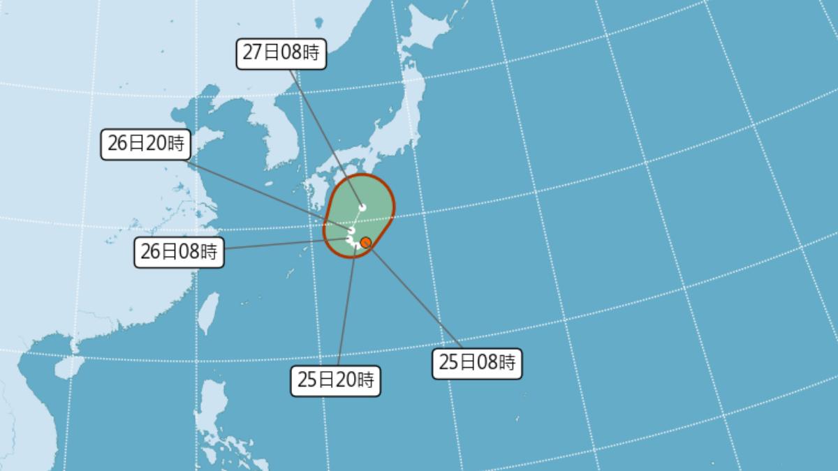
TAIPEI (TVBS News) — The Central Weather Administration (CWA, 中央氣象署) announced on Wednesday (Sept. 25) that the tropical depression near the Ryukyu Islands has intensified into Tropical Storm Cimaron (西馬隆), the 16th of the year.
The storm is expected to move towards the waters south of Japan, posing no direct threat to Taiwan, the CWA stressed.
However, the weather administration warned that a new tropical system could form in Taiwan's southeastern waters within the next one to two days. If this system approaches Taiwan and is accompanied by northerly winds, northern and eastern regions may experience rainfall.
Due to Taiwan's current position in a low-pressure zone with abundant moisture, frequent rainfall is likely. The CWA advised residents to carry rain gear when going out to prepare for sudden weather changes.
The weather fan page TyTech Taiwan (台灣颱風論壇|天氣特急) noted that the overall environment is not conducive to Cimaron's strengthening. It states that even if it develops into a typhoon, its lifespan will be quite brief, with a general direction turning northeast.
TyTech Taiwan also predicted that the storm would rapidly pass near the Kansai and Kanto regions of Japan by Friday. They advised people traveling to Osaka, Nagoya, and Tokyo to stay updated on the weather conditions.


