


TAIPEI (TVBS News) — Taiwan faces scorching temperatures exceeding 38 degrees Celsius (100.4°F) over the coming days as a powerful Pacific high pressure system dominates regional weather patterns Monday (Sept. 15). The Central Weather Administration (中央氣象署), Taiwan's national meteorological service, forecasts mostly sunny to partly cloudy conditions with scattered brief thunderstorms across the island. East to southeast winds accompanying the high pressure system will maintain the sweltering conditions throughout the region.
Meteorologist Wu Der-romg (吳德榮) issued warnings about dangerous heat levels surpassing 38 degrees Celsius (100.4°F) persisting through the next two days. Wu anticipates brief afternoon precipitation and thunderstorm activity concentrated in mountainous terrain, while elevated moisture levels on Taiwan's eastern coastline will particularly impact the Hengchun Peninsula (恆春半島), Hualien, and Taitung counties. These eastern regions face heightened risks of sudden weather changes during afternoon hours.
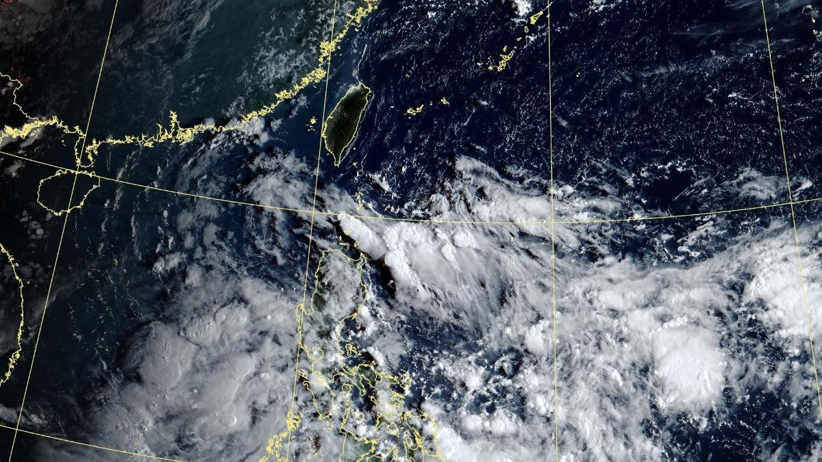
Wu forecasts a tropical disturbance moving across Luzon Island Wednesday through Friday (Sept. 17-19) before advancing into the South China Sea region. This weather system will substantially increase atmospheric moisture levels across Taiwan's eastern territories and the Hengchun Peninsula (恆春半島), triggering more frequent afternoon thunderstorm development. Temperatures will experience marginal decreases during this period while maintaining oppressively hot conditions throughout the affected areas.
Unstable atmospheric conditions Saturday (Sept. 20) could generate substantial thunderstorm activity across Taiwan before moisture levels begin declining Sunday (Sept. 21). The weather transition will restore clear, intensely hot conditions with isolated afternoon precipitation primarily affecting mountainous regions throughout the island. Certain lowland areas may experience heavy rainfall during this atmospheric shift, creating localized flooding risks in vulnerable zones.

