








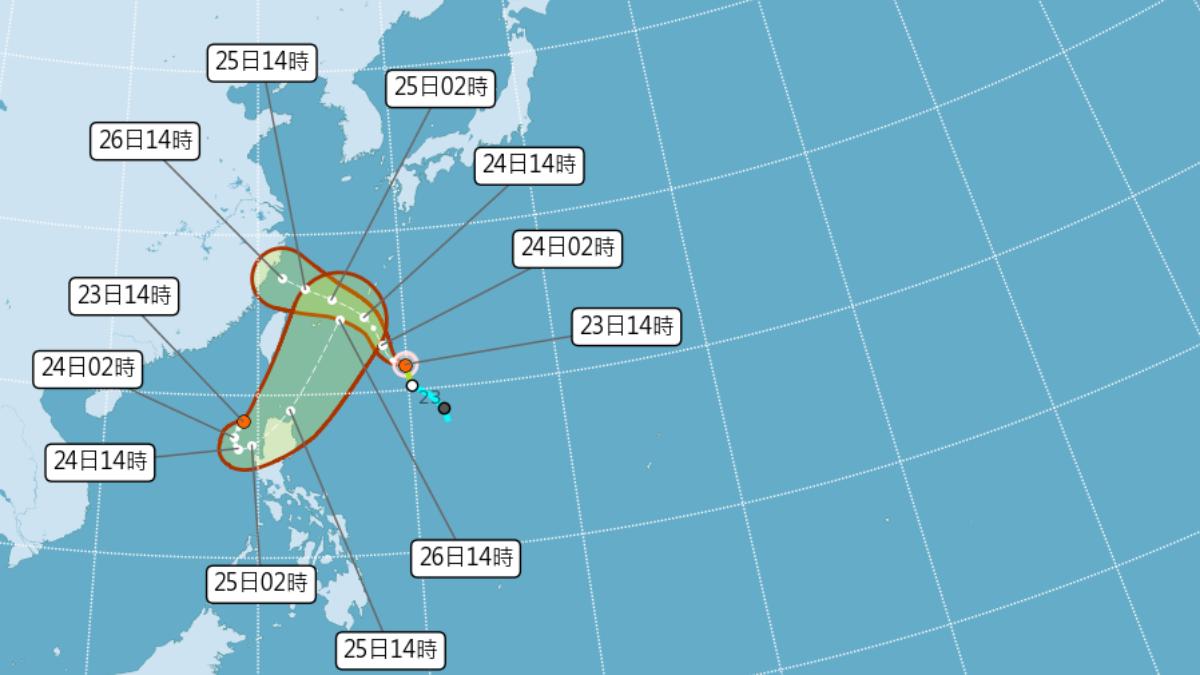
TAIPEI (TVBS News) — Typhoon Francisco (范斯高), the seventh tropical cyclone to impact Taiwan this year, formed Wednesday (July 23) morning and advanced northwest at 17 kilometers per hour (10.6 mph). The Central Weather Administration (CWA, 中央氣象局) Taiwan's national meteorological agency warned the storm will approach the island closely Thursday and Friday, threatening northern and northeastern regions with torrential rainfall and dangerous conditions.
The administration upgraded a low-pressure system northwest of the Philippines to tropical depression status, predicting it may intensify into a tropical storm Thursday. CWA meteorologist Lin Bing-yu (林秉煜) stated that Typhoon Francisco could weaken to tropical depression strength by late Friday night or Saturday before tracking toward the Matsu Islands Taiwan's offshore archipelago and mainland China, with officials indicating a low probability of issuing formal weather warnings.
Lin emphasized that residents of Matsu and other vulnerable regions should maintain vigilance if Typhoon Francisco weakens more gradually or shifts southward, as meteorologists continue monitoring conditions for potential warning issuance. Northern Taiwan and Keelung's northern coastline face heightened flood risks July 24 and July 25 from the dangerous combination of astronomical tides and heavy rainfall. The convergence of these weather phenomena could trigger significant coastal inundation across the island's northern shores.
Weather conditions will remain highly unstable July 26 and July 27 as Typhoon Francisco continues weakening while tracking westward across the Taiwan Strait. Wind patterns will shift to westerly and southwesterly directions under the influence of an approaching low-pressure system, prolonging the region's unsettled atmospheric conditions. Residents across affected areas should monitor official weather updates closely and maintain emergency preparedness for potential advisories or warnings. ◼