


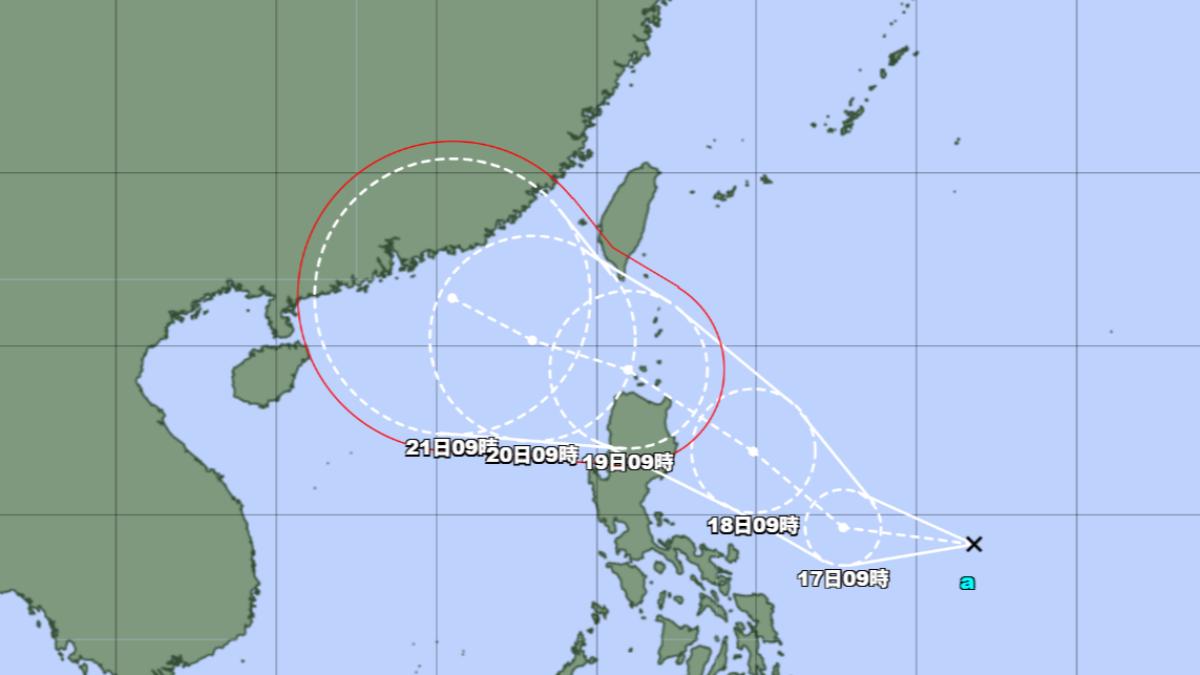
TAIPEI (TVBS News) — Meteorologist Wu Der-romg (吳德榮) has forecasted the imminent formation of Typhoon Wipha (薇帕) in his Thursday (July 17) afternoon column for National Central University (NCU, 中央大學), a leading Taiwanese academic institution. The developing storm system is expected to traverse the northern tip of Luzon Island before entering the South China Sea. Wu indicated that the latest European weather model predicts clear and hot conditions across Taiwan on Thursday, with isolated afternoon thunderstorms developing primarily in mountainous regions.
The Central Weather Administration (CWA, 氣象署), Taiwan's national meteorological agency, has issued a high-temperature alert for Thursday. The alert warns of potential consecutive readings of 36 degrees Celsius (96.8°F) around midday in Taipei City, New Taipei City, and Changhua County. Wu projected that moisture from Typhoon Wipha's outer circulation would begin affecting Taiwan by Friday (July 18) afternoon. This weather pattern will generate scattered precipitation primarily across the island's eastern regions.
Wu emphasized heightened precipitation risks for Taiwan's eastern regions and Pingtung County as Typhoon Wipha traverses either the Bashi Channel or northern Luzon. This weather pattern is expected between Saturday and Sunday (July 19-20). The meteorologist further cautioned that international weather models indicate the potential development of another tropical system. This new system could form within the monsoon trough from Monday (July 21) through Thursday (July 24). Wu recommends vigilant weather monitoring in the coming week. ◼

