


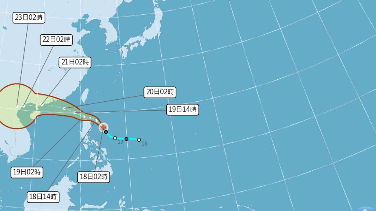
TAIPEI (TVBS News) — Taiwan's national meteorological agency, the Central Weather Administration (中央氣象署), issued a sea warning Friday (July 18) after tropical storm Wipha (颱風薇帕) shifted slightly northward in its projected path. Officials activated the alert at 11:30 a.m. after tracking the storm's center at 16.8 degrees north latitude and 125.0 degrees east longitude, where it was moving northwest at 15 kilometers per hour with a central pressure of 998 hectopascals.
Wipha poses a significant threat with maximum sustained winds near its center reaching 18 meters per second and gusts up to 25 meters per second. Weather officials report the storm's gale-force winds extend in a 100-kilometer radius, with the system expected to make its closest approach to Taiwan today and tomorrow. Meteorologist Wu Der-rong (吳德榮) warned that Wipha's outer circulation would bring scattered showers to western Taiwan, while eastern regions and southern Pingtung county should prepare for heavy rainfall.
Wu further cautioned about another potential weather threat developing between Monday and Thursday next week. Global forecast models show a new tropical system forming within a monsoon trough, carrying a 50% probability of affecting northern Taiwan. The meteorologist described the system's potential trajectory as "menacing" and warned it could create hazardous conditions across the island, though he emphasized that its precise development pattern remains uncertain.
Taiwan's 23 million residents have been advised to stay vigilant and prepare for possible transportation disruptions and flooding as the dual weather threats approach. The Central Weather Administration has pledged to issue regular updates as both systems evolve, with particular concern for coastal areas that may face dangerous sea conditions in the coming days. ◼

