


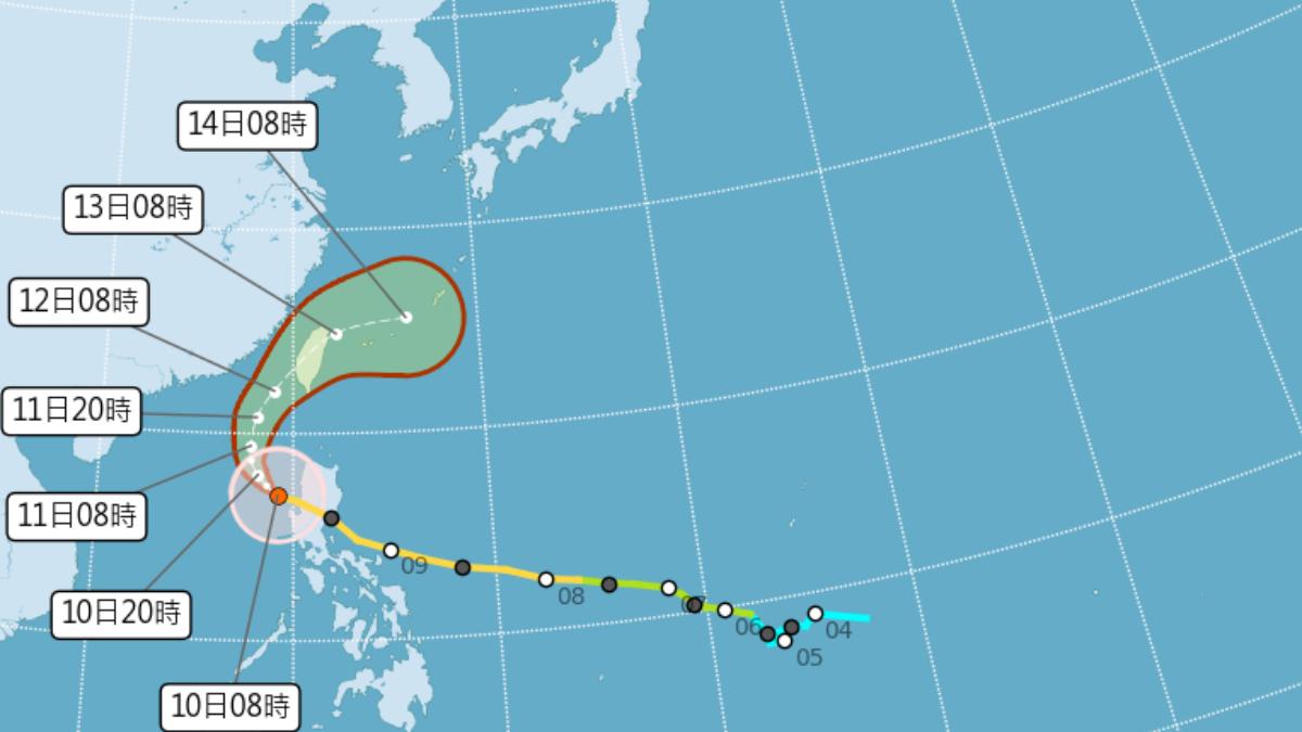
TAIPEI (TVBS News) — Typhoon Fung-wong has shifted course, forcing Taiwan's Central Weather Administration, the national weather agency, to advance landfall warning to Wednesday (Nov. 12) afternoon. The powerful typhoon now targets areas south of Taichung, with Tainan and Chiayi facing highest impact risk as CWA prepares sea warning Monday (Nov. 10) at 5:30 p.m.
CWA officials confirmed the typhoon shifted southward from its original late Wednesday night or early Thursday landfall timeline, shortening distance to Taiwan. Taiwan Typhoon Forum reports intermittent strong winds and heavy rain already hitting northern regions including Keelung, Yilan, Hualien, and Taitung from typhoon circulation and northeast monsoon effects.
Severe rainfall threatens Keelung's north coast and eastern counties Yilan, Hualien, and Taitung, with heightened landslide warnings for dangerous Suhua mountainous areas. Northern and eastern Taiwan face peak weather impact Monday (Nov. 10) to Tuesday (Nov. 11), while Miaoli remains relatively protected by Xueshan Mountain Range natural barriers.
Southern counties from Yunlin to Pingtung face increasing winds and rain starting Tuesday (Nov. 11), intensifying Wednesday (Nov. 12) as the powerful typhoon core approaches landfall. Taiwan's outlying islands Penghu, Kinmen, and Matsu endure strong gusts throughout the storm period, with typhoon core directly hitting Penghu Wednesday (Nov. 12) night. ◼

