










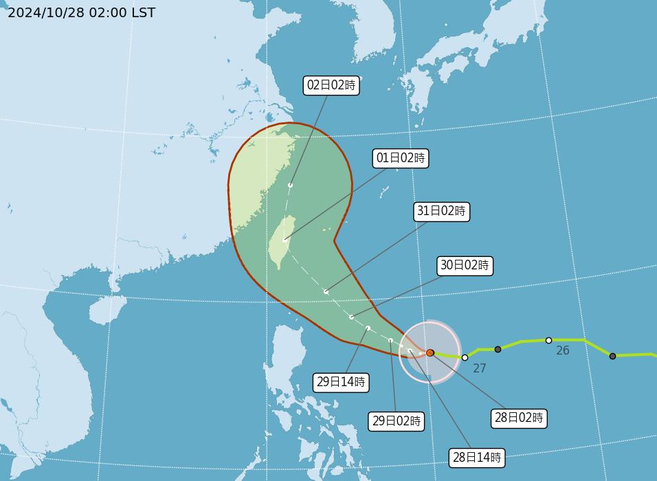
TAIPEI (TVBS News) — The Central Weather Administration (CWA, 中央氣象署) announced on Monday (Oct. 28) that Typhoon Kong-rey (康芮) poses a high likelihood of prompting sea and land warnings. Authorities expect to issue a sea warning as early as Tuesday.
CWA forecaster Chang Chun-yao (張竣堯) indicated that the typhoon's intensity nears the upper limit of a mid-strength typhoon, with the potential to escalate into a strong typhoon.
As of 2 a.m. Monday, the typhoon's center is 1,160 kilometers southeast of Eluanbi (鵝鑾鼻), moving west-northwest toward Taiwan's eastern waters. The CWA forecasts that Kong-rey will impact Taiwan's weather from Oct. 30 to Nov. 1.
Meanwhile, WeatherRisk analyst Wu Sheng-yu (吳聖宇) noted that Kong-rey's path remains unpredictable, with significant variations in the forecasted trajectory. Wu highlighted the possibility of further adjustments, including shifts westward or southward.